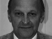
Armin Gruen
 ETH Zurich
"Positioning, Modeling and Navigation with Photogrammetric
Techniques"
Abstract: Photogrammetry belongs to the Imaging Sciences. In R&D it focuses on issues like sensor and system integration and modeling, precise georeferencing and object reconstruction, quantitative image analysis, establishment of internal quality control procedures, etc. We work with satellite, aerial and terrestrial imaging devices. This contribution will highlight some of the latest developments and achievements, like attainable level of accuracy in point and object positioning, 3D reconstruction and modeling, kinematic positioning with sequential estimation and others. After an overview of typical applications we will demonstrate the procedures with results from videogrammetric deformation monitoring of some of ESA's deep space structures (Planck, Herschel, Gaia - accuracy 1:1'000'000), 3D city and landscape modeling, cultural heritage documentation, mobile mapping, UAV photogrammetry. We argue that photogrammetric techniques can also favorably be used in robotics.
Biography: Prof. Dr. Armin Gruen is since 1984 Professor and Head of the Chair of Photogrammetry at the Institute of Geodesy and Photogrammetry, Federal Institute of Technology (ETH) in Zuerich, Switzerland. He graduated 1968 as Dipl.-Ing. in Geodetic Science and obtained his doctorate degree 1974 in Photogrammetry, both from the Technical University Munich, Germany. From 1969 to 1975 he worked as Assistant Professor, and until 1981 as Associate Professor, at the Institute of Photogrammetry and Cartography, Technical University Munich. From 1981 to 1984 he acted as Associate Professor at the Department of Geodetic Science and Surveying, The Ohio State University, Columbus, Ohio, USA.
Prof. Gruen has held lecturing and research assignments at the University of Armed Forces, Munich, Germany, Helsinki University of Technology, Finland, Universita degli Studi di Firenze, Italy, Stanford Research Institute, Menlo Park, USA, Department of Geodesy, Technical University Delft, Netherlands and Department of Geomatics, University of Melbourne, Australia. He has lectured at the University level since 1969, with photogrammetry and remote sensing as major subjects, surveying, cartography and adjustment calculus as minor subjects. He served as the Head of the Department of Geodetic Sciences 1996-97 and as the Dean of Faculty "Rural Engineering and Surveying" of ETH Zurich (1996-98).
He is promoter and Director of the Postdiploma Course "Spatial Information Systems" at the ETH Zurich and Co-founder of CyberCity AG. Through the Commission for Remote Sensing he is Member of the Swiss National Academy of Natural Sciences. He is Member of the Editorial Board of several scientific journals. He has published more than 175 articles and papers and is Editor and Co-editor of eight books and Conference Proceedings. He has organized and co-organized/co-chaired over fifteen international conferences and he has served as a consultant to various government agencies, system manufacturers and engineering firms in Germany, Switzerland, USA and other countries. Also, he served as the President of ISPRS Commission V (International Society of Photogrammetry and Remote Sensing), as ISPRS Council Member (Vice President) and Council Member of IUSM (International Union of Surveys and Mapping), Chairman of the ISPRS Financial Commission and is currently Chairman of ISAC (International Scientific Advisory Committee).

